Analyzing thousands of icebergs captured in time-lapse footage from Alaska and Greenland, this research demonstrates that logistic regression applied to visible width and height can help estimate the probability of instability providing engineers with a foundational, field-derived method for assessing capsize risk in Arctic coastal environments.
The Challenge of Iceberg Capsize in Arctic Waters
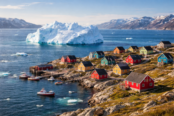
Iceberg capsize, or rollover, occurs when a floating berg suddenly shifts orientation, displacing water and potentially generating localized tsunamis. In Greenland, where nearly all communities are coastal and depend on marine activities for livelihoods, such events represent a meaningful hazard. Residents have reported waves from capsizing icebergs damaging boats and infrastructure, underscoring the need for better predictive tools.
While laboratory experiments and numerical models have clarified the role of geometry, particularly aspect ratio, in stability, real-world application remains limited. Icebergs are irregular, mostly submerged, and observed under variable conditions. This study addresses the gap by examining whether visible geometry from shore-based cameras can inform stability assessments in operational settings.
A Practical Data-Driven Approach to Stability Assessment
The research compiled datasets from time-lapse imagery at LeConte Glacier in Alaska (2016–2018) and four sites in West Greenland (2025). Unstable events; capsizes, fragmentation, or disintegration, were identified visually, and the final pre-event image was used to measure visible width and height in pixels via the open-source CVAT tool. Stable icebergs from the same sequences served as comparators.
Measurements followed a log-normal distribution and were transformed using the natural logarithm for modeling. Hourly air temperature data from nearby stations were incorporated to evaluate environmental influences.
Binary logistic regression was selected for its interpretability and suitability for probabilistic outputs. To address class imbalance (Alaska: 2,066 stable, 479 unstable; Greenland: 104 stable, 16 unstable), three approaches were tested: no sampling, random majority undersampling (RMU), and synthetic minority oversampling (SMOTE). Models used log-transformed width and height as features, with 80/20 train-test splits and cross-validation.
Findings on Geometry, Temperature, and Model Performance
Air temperature showed no clear association with unstable events in either region. Time-series analysis across seasons revealed no consistent clustering of capsizes during warmer periods.
Visible geometry, however, exhibited a consistent pattern: unstable icebergs tended to have larger dimensions. In Alaska, log-transformed means were higher for unstable cases (width: 4.68 vs. 4.15; height: 3.69 vs. 3.11 for stable), with the shift evident in histograms and violin plots.
Model performance in Alaska indicated usable discriminatory power:
- No sampling: 85.07% accuracy (AUC 0.718)
- RMU: 65.10% accuracy (AUC 0.739)
- SMOTE: 66.14% accuracy (AUC 0.736)
Predicted probabilities increased with larger measurements, aligning with physical expectations.
In Greenland, the limited number of unstable observations constrained results. While overall accuracies appeared reasonable (no sampling: 79.16%; SMOTE: 80.10%), the models largely classified icebergs as stable, offering limited differentiation. The authors note that the small dataset size likely prevented deeper insights, though patterns in geometry mirrored those in Alaska.
The study summarizes its core findings as follows: larger visible portions correlate with greater likelihood of instability, while air temperature shows no evident influence. It positions the work as “a starting point for investigating a potential method to monitor iceberg capsize,” intended as a stepping-stone toward more advanced, autonomous assessment tools.
Path Forward for Engineering Applications
This research contributes a transparent, implementable framework that leverages accessible technology, fixed cameras and straightforward modeling, to extract actionable stability information from real-world observations. It demonstrates that even modest datasets from ground-based imagery can reveal meaningful signals, opening pathways for expanded monitoring networks in high-risk fjords.
Further data collection, integration of additional variables such as water temperature, or multi-view analysis could strengthen predictive capability. The approach offers a model for applied cryospheric engineering focused on direct relevance to community safety.
The authors are to be commended for this careful and well-documented contribution. Sachiko Ka’ikilaniali’iopuna Sakai’s thesis exemplifies the value of bridging field data with practical machine learning.
Engineers, researchers, or practitioners with related field data, instrumentation experience, or ideas for extending this methodology are encouraged to share their perspectives. Collaboration on follow-on studies would be particularly welcome.
Reference
Sakai, S. K. (2025). Iceberg Stability Investigations Using Machine Learning for Alaska and Greenland. Master of Science Thesis, Virginia Polytechnic Institute and State University.