Discover how researchers are transforming urban land administration by integrating cadastral floor plans with nationwide airborne LiDAR to create detailed 3D point clouds, offering a cost-effective alternative to BIM for visualizing legal property boundaries in complex vertical structures—paving the way for scalable digital twins.
The Challenge of Vertical Urbanization in Land Administration
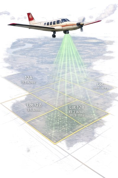
Urban areas are experiencing rapid vertical growth, leading to more apartment buildings and complex 3D property structures. Land Administration Systems (LAS) must accommodate these developments by storing and visualizing legal statuses in three dimensions. LAS involves mapping land parcels and registering Rights, Restrictions, and Responsibilities (RRRs), but traditional 2D systems are inadequate for representing vertical boundaries and homogeneous RRRs across 3D spatial units.
Building Information Models (BIM) have been utilized in studies for 3D representations in digital twins, showing capability for LAS. However, BIM is not available for all buildings, particularly older ones, creating a significant limitation. This gap is critical because accurate 3D visualization supports legal clarity, reduces boundary disputes, and aids urban management. Point clouds from Airborne Laser Scanning (ALS) provide an alternative, capturing geometric and semantic data. In the Netherlands, the Actueel Hoogtebestand Nederland (AHN) offers nationwide LiDAR with height accuracy up to 5 cm and densities of 10-14 points per square meter in recent versions. Yet, AHN captures only exterior envelopes, lacking interior details like walls and slabs needed for property boundaries.
Studies have explored point clouds for 3D LAS: one linked them to the Land Administration Domain Model (LADM) for change detection, distinguishing legal from temporary changes, though limited to a university setting. Another reconstructed BIM from Terrestrial Laser Scanning (TLS) point clouds, but this is costly and time-intensive for large scales. Cadastral floor plans, required in Dutch notarial deeds, depict boundaries with thick lines for properties, but parsing scanned drawings is necessary for digital use. Addressing this enables realistic 3D LAS using existing data, supporting legal space definition and integration with real-world features like facades and fences that define boundaries.
A Semi-Automated Pipeline for Point Cloud Generation
The research develops a semi-automated pipeline using three cadastral apartment drawings from Rotterdam (1999, 2002, 2019) to generate 3D point clouds for LAS visualization. It addresses floor plan parsing, AHN integration, and spatial unit representation.
Parsing starts with preprocessing a PDF scan. EasyOCR detects floor keywords and cadastral IDs; OpenCV identifies contours to crop floors into PNGs. Vectorization converts to grayscale, applies inverted binary thresholding, and morphological operations: opening (kernels 2×2-3×3, iterations 1-3) removes noise, closing (5×5-20×20, iterations 1-2) fills gaps. Contours are simplified with epsilon (0.001-0.013), areas under 500 pixels removed, and polygons formed using Shapely’s simplify (1-10) and buffer (5-8) for rectangularization. OCR assigns room numbers; polygons export to GeoPackage layers.
Georeferencing aligns to PDOK.nl cadastral footprints via MBRs. Orientations are computed from convex hull edges, rotating to minimize bounding box area. Scale factors compare extents; translations align corners. Manual rotations adjust for symmetry.
AHN integration combines versions 1-5 to address occlusions, cropping with 1-meter buffer. Ground classification uses PDAL’s CSF with parameters for flat terrain: resolution, time step, rigidness.
Segmentation applies Open3D’s RANSAC on non-ground points (0.3m threshold, min 3 points). Normals estimate angles to Z-axis: flat roof (<25°), sloped roof (25-60°), wall (>60°).
Synthetic point cloud generation loads layers, places boundary points at 0.05m spacing (20 points/m²). Points extrude vertically; ground height from AHN ground, ceilings from averaged roof height divided by floors. Interiors grid for floors/ceilings; points to LAZ with attributes, unique IDs, classifications.
Alignment uses ICP variants: point-to-point and point-to-plane minimize distances. Better method selected; combined with AHN into LAS, preserving attributes.
This pipeline synthesizes room-level point clouds from available data, enabling semantic enrichment without surveys or BIM.
Findings from Rotterdam Case Studies
The pipeline parsed and vectorized floor plans, distinguishing property boundaries in the 2019 drawing but generating room segments for older ones due to indistinct lines. Manual cleaning addressed noises like stairs in two samples. Georeferencing RMSEs were 18.25-32.18 cm. Combining AHN versions increased building points, though walls remained sparse, especially shared in row houses.
Segmentation extracted ground points but challenged separating walls/roofs, retaining outliers and vegetation. ICP alignment initial RMSEs 1.406-1.478 cm, post-alignment 1.459-1.480 cm for point-to-point, 1.537 cm for point-to-plane in one sample; correspondences increased to 62-314.
Processing times 44-97 seconds per sample, excluding manual steps. Visualizations integrated synthetic clouds with AHN in Cesium, representing features.
The approach generates spatial units without BIM or surveys, with RMSEs aligning to Dutch cadastral standards (20 cm urban). Limitations include manual interventions for older drawings and OCR.
Broader Applications and Research Directions
This method supports 3D LAS in regions lacking BIM, with potential for international adaptation via varied formats and LiDAR alternatives. As stated, “the system is capable of generating a synthetic building point cloud in under two minutes per sample, indicating the feasibility of future nationwide implementation.”
We thank Citra Andinasari, Peter van Oosterom, and Edward Verbree for their contribution to geospatial research. If you have insights or wish to collaborate, contact them at TU Delft. For more, see: Andinasari, C., van Oosterom, P. J. M., & Verbree, E. (2025). Point Clouds for 3D Land Administration: Integrating Floor Plans and Nationwide Airborne LiDAR (AHN). International Archives of the Photogrammetry, Remote Sensing and Spatial Information Sciences – ISPRS Archives, 48(4/W15-2025), 9-16. https://doi.org/10.5194/isprs-archives-XLVIII-4-W15-2025-9-2025.