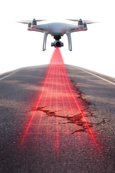
What if engineers could scan entire road networks from the air and spot damage early, quickly, and safely? With drones and AI working together, pavement inspection is beginning to move from boots on the ground to intelligence in the sky. Here’s how UAV imagery and the YOLOv7 deep learning model support faster, safer, and more scalable road inspection workflows.
The Hidden Cost of Pavement Deterioration
Roads are a critical component of modern transportation networks. They support commuters, freight, emergency services, and public transit. Over time, however, pavement deteriorates. Weather exposure, aging materials, and heavy traffic gradually lead to cracks and potholes that affect safety, ride quality, and infrastructure lifespan.
For engineers and asset managers, the challenge is to detect damage early, prioritize interventions, and allocate maintenance budgets effectively. Early detection often means simpler and less costly repairs. In this sense, inspection plays an important role in risk management and long-term infrastructure sustainability.
Inspections Without Drones and Deep Learning
Traditionally, pavement inspections relied on trained field crews or specialized vehicles equipped with tools such as laser scanners, infrared sensors, or ground-penetrating radar. These approaches can produce valuable data, but they typically require significant time, labor, and traffic management. They can also expose personnel to safety risks when working near active roadways.
Engineers have also used digital image processing techniques—such as thresholding and edge detection—to identify cracks in images. While useful in controlled settings, these methods are sensitive to shadows, stains, and lighting variability.
Machine learning introduced improvements by learning from labeled examples. Methods such as Support Vector Machines and Random Forests supported defect classification but often depended on handcrafted features and had limited adaptability across pavement types.
Deep learning significantly advanced the field. Convolutional Neural Networks (CNNs) can learn features directly from images, improving detection robustness. Object detection models such as Faster R-CNN, SSD, and the YOLO (You Only Look Once) family enabled real-time detection, while segmentation models like U-Net allowed pixel-level mapping of damage.
Despite these advances, generalization remains a challenge. Models trained on one dataset or pavement type do not always transfer well to others. Limited labeled data and real-world variability continue to constrain performance.
The Research
This study examined a practical question:
Can a system combining UAV imagery and the YOLOv7 model detect and classify common pavement defects from aerial images with useful accuracy?
The target defects were:
- Longitudinal cracks
- Reflective cracks
- Alligator cracks
- Potholes
The goal was to develop a scalable and automated framework that reduces manual workload and supports proactive maintenance. A notable aspect of the study is its focus on generalization: the model was trained on public datasets and evaluated on independent UAV imagery from a different environment.
The Approach: UAVs and YOLOv7
Why UAVs?
Unmanned aerial vehicles (UAVs) offer several practical advantages:
- Rapid coverage of large areas
- Access to hard-to-reach locations
- Reduced exposure of personnel to traffic hazards
In this study, a DJI Mavic 2 Pro captured 102 RGB images along 1.4 km of roadway at altitudes between 15 and 25 m under varying lighting conditions. Sixty-six images containing visible defects were annotated and later cropped into 1,930 tiles. Importantly, these UAV images were reserved exclusively for testing, not training, ensuring an unbiased evaluation.
Why YOLOv7?
YOLOv7 is known for balancing detection accuracy and inference speed, which is important for near-real-time inspection scenarios. Its architecture—including Extended Efficient Layer Aggregation Networks (E-ELAN) and compound scaling—supports detection of objects at multiple scales, including thin and irregular cracks.
Training Data Strategy
The model was trained using five public datasets:
- Crack500
- GAPs
- CFD
- CrackTree
- DeepCrack
Images were normalized and augmented using flips, brightness and contrast adjustments, noise injection, cropping, and partial grayscale conversion. Less frequent classes, such as reflective cracks and potholes, were oversampled. Non-defective pavement images containing shadows or vegetation were also included so the model could better distinguish defects from background features.
An important practical takeaway is that robust detection models require examples of both damage and normal pavement under varied conditions.
What the Field Tests Revealed
On the independent UAV test set, the model achieved:
- Precision: 0.51
- Recall: 0.45
- mAP@0.5: 0.42
Performance was stronger for longitudinal and alligator cracks and lower for reflective cracks and potholes.
Many misclassifications were associated with shadows, vegetation, and resolution differences. These results reflect the variable conditions encountered in real-world inspections rather than controlled laboratory scenarios.
Overall, the system demonstrates automated detection capability. Even moderate accuracy can be useful for screening and prioritization at the network level.
What This Means for Infrastructure Management
For infrastructure owners and municipalities, this approach suggests potential benefits such as:
- Faster network-level surveys
- Reduced manual inspection effort
- More frequent monitoring cycles
- Safer inspection workflows
Future work may include:
- Domain adaptation for aerial imagery
- Incorporation of newer transformer-enhanced models
- Expanded defect categories
- Hybrid detection-segmentation methods for severity assessment
As datasets and models continue to improve, UAV-AI systems could become a practical first-pass tool within pavement management systems.
A Step Toward Smarter Road Monitoring
This YOLOv7-UAV framework is not a complete solution, but it represents a meaningful step forward. The study shows that automated drone-based road inspection is technically feasible and operationally promising.
AI systems are best viewed as tools that support, rather than replace, professional judgment. Used appropriately, they can help inspection teams focus attention where it is most needed.
The work by Tuğba Yıldızlı, Merve Bayraktar, and Burcu Güldür Erkal illustrates how civil engineering and AI are increasingly intersecting in infrastructure monitoring. Continued progress in this area may contribute to safer roads, more efficient maintenance planning, and longer-lasting infrastructure.
For deeper insights, refer to: Yıldızlı, T., Bayraktar, M., & Erkal, B. G. (2025). Automated Road Damage Detection Using UAVs and Deep Learning: A Scalable Solution for Infrastructure Maintenance. e-Journal of Nondestructive Testing, Article 5701. https://doi.org/10.58286/31691