New research reveals how smarter, streamlined bedrock modeling can closely match complex 3D simulations, transforming Antarctic ice-sheet forecasts. By boosting speed without sacrificing accuracy, it sharpens sea-level rise predictions, empowers larger climate ensembles, and equips planners worldwide with clearer insights for coastal futures ahead today.
A Serious Issue
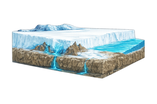
Antarctic ice melt contributes to sea-level rise, posing risks to coastal areas through flooding and erosion as climate change progresses. This affects societies globally, impacts ecosystems, challenges infrastructure development, and requires informed policies for environmental and structural resilience.
Consider the bedrock
Antarctic Ice Sheet forecasts often ignore bedrock uplift or used basic Earth models, as full 3D simulations with varying mantle viscosity were too computationally demanding for century-scale runs. The elastic lithosphere, relaxed asthenosphere (ELRA) model paired with ice-sheet simulators typically featured a fixed 3000-year relaxation time—representing mantle rebound—and a stiffness matching a 100 km thick lithosphere, akin to a 10^21 Pa s viscosity. Some studies opted for 1D glacial isostatic adjustment (GIA) models, varying viscosity with depth but not laterally, or half-space setups with uniform 10^21 Pa s upper mantle viscosity. Yet, these setups barely altered sea-level estimates from rigid Earth cases, overestimating projections by up to 20% by 2500 versus lower-viscosity 1D or 3D models. In low-viscosity spots like the Amundsen Sea (down to 10^18 Pa s), adding weak zones to 1D models stabilized sheets over millennia, but prior West Antarctic relaxation times over 1000 years missed multi-centennial impacts. Laterally varying ELRA reduced sea-level contributions over multicentennial-to-millennial scales, but lacked comparisons against 3D GIA-coupled outputs, leaving their precision unclear.
This study examines how well simplified models can approximate 3D GIA results for Antarctic sea-level contributions. Key questions: What are the optimal parameters for uniform-relaxation ELRA, laterally varying ELRA (LVELRA), and 1D GIA to match reference 3D outcomes? It uses a relation between relaxation time and viscosity derived from 3D experiments, then evaluates setups in 500-year runs with CESM/IPSL climates under SSP1-2.6/SSP5-8.5, assessing fits in sea-level rise, grounding lines, ice thickness, and uplift.
An Innovative improvement
This study evaluates cost-effective Earth models to approximate 3D GIA setups in ice-sheet simulations, supporting broader forecast ensembles. It derives an empirical relation between relaxation time and mantle viscosity from 3D unload tests, generating variable 2D maps for ELRA. Maps are based on seismic-constrained weaker and stronger 3D setups from Amundsen and Weddell observations. These are implemented alongside uniform ELRA times and 1D profiles in IMAU-ICE couplings, forced by CESM/IPSL under low and high emissions. The work quantifies precision through comparisons of sea-level, grounding, thickness, and uplift differences—showing that high-viscosity simplifications overestimate rises, while recommended parameters (300-year uniform ELRA at 100 km lithosphere) limit deviations to under 40 cm (6%) from 3D averages by 2500; 2D-stronger at 120 km reduces to 10 cm (2%); 1D at 10^19 Pa s limits bed errors to 80 m, capturing depth-dependent responses. This supports feasible inclusion of GIA feedbacks.
Bring these innovations to the future for better predictions and insights
Rigid Earth runs yield 3–7.5 m sea-level rise by 2500 with significant basin retreats. ELRA at uniform 300 years deviates less than 40 cm (6%) from 3D GIA averages. 1D GIA at 10^19 Pa s upper mantle reduces to 20 cm (4%), LVELRA maps to 10 cm (2%). 3D models show uplift slowing on longer timescales due to deeper high-viscosity layers; simplified models with recommended parameters approximate overall Antarctic contributions sufficiently accurately.
These findings support large ensemble simulations, refining sea-level outlooks for coastal planning. Applications include other regions like Greenland, benefiting climate scientists and policymakers. Further research could incorporate sea-level feedbacks or refine viscosity maps from new seismic data.
As Antarctic ice loss increases, accurate models are essential for addressing coastal challenges and supporting sustainability. Thanks to Caroline J. van Calcar and colleagues for this contribution to modeling; as they conclude, simplified models with derived parameters “can be approximated sufficiently accurate.” Share ideas at c.j.vancalcar@tudelft.nl. For more, see “Approximating 3D bedrock deformation in an Antarctic ice-sheet model for projections,” The Cryosphere.