Lars Langhorst

UAV Airspeed Estimation using Propeller Feedback

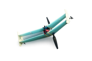
Researchers at Delft University of Technology have developed an analytical model that estimates fixed-wing UAV airspeed using only propeller power and rotational speed feedback from standard electronic speed controllers. This computationally efficient, model-free solution provides a practical alternative or redundancy to conventional Pitot tubes, achieving strong accuracy on real flight data.  The Challenge of Reliable […]

UAV Airspeed Estimation using Propeller Feedback Read More »

Revolutionizing Immersed Tunnel Monitoring: How Optical Fibers Reveal Seasonal Joint Movements

Seeing Tunnel Movements in a New Light For the first time, distributed optical fiber sensors (DOFS) have been used to continuously track how every joint along an immersed tunnel moves through the seasons. The results show—clearly and quantitatively—how temperature cycles drive joint opening and closing. For engineers responsible for aging tunnel infrastructure, this is a

Revolutionizing Immersed Tunnel Monitoring: How Optical Fibers Reveal Seasonal Joint Movements Read More »

Volumetric Disentanglement: A Practical Path to Object-Level Editing in NeRF Scenes

Neural Radiance Fields (NeRFs) have changed how engineers think about 3D capture. With a modest set of photos, you can reconstruct impressively photorealistic 3D scenes. For many teams, that alone feels like magic. But then comes the real-world question: How do you edit those scenes? Remove a chair. Enlarge a TV. Swap out a tree

Volumetric Disentanglement: A Practical Path to Object-Level Editing in NeRF Scenes Read More »

Machine Learning Meets Soil Dynamics

A data-driven review shows how modern machine-learning models consistently outperform traditional empirical equations in predicting soil shear modulus and damping ratio, offering geotechnical engineers a clearer, more efficient path to characterizing dynamic soil behavior while highlighting practical limitations, data requirements, and future research needs. Why Soil Dynamics Still Challenge Engineers Accurate characterization of soil dynamic

Machine Learning Meets Soil Dynamics Read More »

Advancing 3D Land Administration with Point Clouds

Discover how researchers are transforming urban land administration by integrating cadastral floor plans with nationwide airborne LiDAR to create detailed 3D point clouds, offering a cost-effective alternative to BIM for visualizing legal property boundaries in complex vertical structures—paving the way for scalable digital twins. The Challenge of Vertical Urbanization in Land Administration Urban areas are

Advancing 3D Land Administration with Point Clouds Read More »

Shanghai’s 30-Year Land Subsidence Evolution

Dive into Shanghai’s sinking secrets: This study fuses 30 years of multi-sensor satellite data with AI modeling to map subsidence shifts from urban cores to coastal zones, revealing how groundwater management curbs rates and offers strategies for flood-resilient cities. The Subsidence Challenge Land subsidence in coastal megacities like Shanghai endangers infrastructure, increases flood risks, and

Shanghai’s 30-Year Land Subsidence Evolution Read More »

Unlocking 3D Printed Concrete

Dive into the Mechanics: How Printing Shapes Concrete’s Strength and Reliability in a Groundbreaking Interlaboratory Effort Spanning 30 Labs Worldwide Why Mechanical Properties in 3DCP Are Critical 3D concrete printing facilitates efficient, sustainable construction, but variable mechanical properties challenge structural reliability. As applications expand internationally, this variability hinders code compliance and broader implementation, affecting engineers,

Unlocking 3D Printed Concrete Read More »

Advancing Road Inspections with Drones and AI

What if engineers could scan entire road networks from the air and spot damage early, quickly, and safely? With drones and AI working together, pavement inspection is beginning to move from boots on the ground to intelligence in the sky. Here’s how UAV imagery and the YOLOv7 deep learning model support faster, safer, and more

Advancing Road Inspections with Drones and AI Read More »

Indoor Positioning Using Augmented Reality

Imagine stepping into a smoke-filled building during an emergency, where every second counts and traditional navigation fails—yet augmented reality glasses reveal your precise location on a digital floor plan, guiding rescuers to safety. In his 2020 MSc thesis, Laurens Oostwegel pioneered a solution using the Microsoft HoloLens to combat SLAM’s drift errors through continuous spatial

Indoor Positioning Using Augmented Reality Read More »

Green Corridors as Blueprints for Sustainable Port-Cities

Forging “Zero-Emission Highways of the Sea”: New research maps how international collaboration between ports, cities, and industries is creating the first viable pathways to decarbonize global maritime trade. Zero-Emissions Shipping, in our cities and backyards Maritime shipping is the backbone of global trade but a major source of greenhouse gases, with emissions projected to surge

Green Corridors as Blueprints for Sustainable Port-Cities Read More »