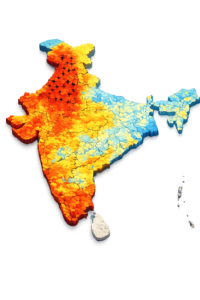
Satellite Data Reveals Regional Patterns in India’s Groundwater Depletion
Utilizing GRACE gravity measurements, ERA5 precipitation records, and MODIS land cover classifications, this analysis examines seasonal and regional variations in groundwater storage across India, identifying negative correlations with cropland and urban expansion in northern areas while emphasizing the need for diversified water management to address ongoing depletion. Groundwater Depletion in India: The Problem and Its […]
Satellite Data Reveals Regional Patterns in India’s Groundwater Depletion Read More »