Lidar object detection for Safer Maritime Navigation
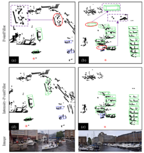
Researchers have developed a LiDAR intensity-enhanced 3D object detection method, improving accuracy in complex marine environments.
Lidar object detection for Safer Maritime Navigation Read More »