This research delves into the complex dynamics of sea level variations in French Polynesia. By comparing tide gauge and GNSS data with advanced oceanographic models, it highlights regional climate phenomena’s impact on coastal submersion risks, offering a more reliable estimation of relative sea level rise and vertical land motions.
Understanding the Challenge
Rising sea levels are a critical threat to coastal areas globally, and French Polynesia is particularly vulnerable due to its geological characteristics and land subsidence. Accurate assessment of sea level changes is essential for evaluating coastal submersion risks, which directly impact local communities. Traditional methods like satellite altimetry often overlook vertical land motions, leading to potential inaccuracies in flooding risk assessments. This study addresses the need for a nuanced understanding of sea level variations by integrating data from tide gauges (TG), Global Navigation Satellite System (GNSS), and the GLORYS ocean reanalysis model, aiming to provide a clearer picture of the submersion hazards in French Polynesia.
Innovative Methodology
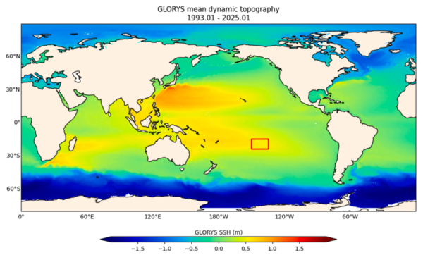
The study uses a comparative analysis of data from multiple sources to evaluate sea level changes across French Polynesia. It compares 11 years of tide gauge data and GNSS measurements with 27 years of gridded sea level data from the GLORYS model. Tide gauges measure relative sea level variations (ΔRSL), while GNSS data provide insights into vertical land motions (VLM). The GLORYS model offers absolute sea level variations (ΔASL) crucial for understanding regional ocean dynamics.
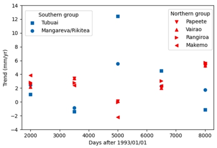
The research categorizes tide gauge sites into two groups based on location: a Northern group (Society and Tuamotu archipelagos) and a Southern group (Gambier and Austral islands). This helps in understanding regional differences in sea level trends influenced by climate indicators like the Interdecadal Pacific Oscillation (IPO), Pacific Decadal Oscillation (PDO), and El Niño Southern Oscillation (ENSO). A key innovation is subtracting GLORYS data from tide gauge data, eliminating common inter-annual variability and providing a proxy for determining VLM, enhancing the reliability of ΔRSL trends compared to GNSS-derived VLM records.
Key Findings
The study finds that inter-annual variability, particularly the IPO, significantly affects the determination of ΔASL from the GLORYS series. The 11-year tide gauge records are too short to establish reliable long-term ΔRSL trends due to this variability. However, combining tide gauge and GLORYS data yields reliable ΔRSL trends, with values around 2.2 mm/yr at Vairao and Rangiroa. For the Southern group, larger values are observed, primarily due to the IPO’s influence, with corrected rates of 2.45 mm/yr at Rikitea and 3.33 mm/yr at Tubuai. These results highlight the importance of considering regional climate indicators in sea level assessments.
Future Directions and Impact
This research provides a crucial framework for understanding sea level dynamics in climate-vulnerable regions. By integrating multiple data sources and employing innovative analytical techniques, it offers a more accurate assessment of submersion risks, vital for coastal planning and mitigation strategies. The findings could inform future studies and policy decisions aimed at protecting coastal communities in French Polynesia and similar regions worldwide. The authors have laid a foundation for further exploration of regional oceanographic processes and their implications for sea level rise.
For further information or to contribute insights, interested parties are encouraged to contact the authors. Their work represents a significant advancement in coastal engineering and climate research.
Reference: Bernard Ducarme, Marania Hopuare, Xianjie Li, Keitapu Maamaatuaiahutapu, Jean-Pierre Barriot. Trends in the relative sea level rises in French Polynesia for coastal submersion assessment from the comparative analysis of GLORYS and tide gauges / GNSS data. DOI: https://doi.org/10.1016/j.rsma.2026.104950