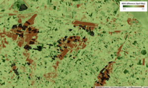
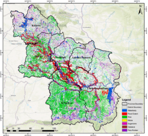
remote sensing

Assessing Crop Flood Damage Using Sentinel-2

Data-Driven Approach to Quantify Agricultural Losses from Flooding Discover a method that combines Sentinel-2 satellite data, topographic information, and field surveys in a random forest model to classify flood damage in 412 agricultural fields, providing quantitative yield loss estimates for the 2023 Emilia-Romagna event and supporting effective compensation strategies in vulnerable areas. Flood Impacts on

Assessing Crop Flood Damage Using Sentinel-2 Read More »