Assessing Regional Digitalization in Europe
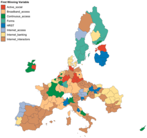
Researchers have developed a composite index to assess regional digitalization in Europe, incorporating spatial heterogeneity and dependence.
Assessing Regional Digitalization in Europe Read More »
Researchers have developed a composite index to assess regional digitalization in Europe, incorporating spatial heterogeneity and dependence.
Assessing Regional Digitalization in Europe Read More »
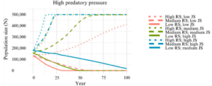
Researchers investigate the complex interaction between Magellanic penguins and pumas in Argentina’s Monte León National Park.
Penguins and Pumas in patagonia Read More »
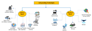
Researchers have developed a machine learning framework to combat poaching by analyzing forest videos. This approach utilizes advanced neural networks to detect wildlife and assess threats, aiming to enhance conservation efforts.
AI for Wildlife Poaching Detection Read More »
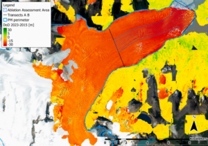
The Perito Moreno Glacier, once noted for its stability, is now rapidly changing. Researchers used remote sensing and mass balance equations to measure its ablation rate, uncovering significant ice loss due to warming and droughts, signaling a vital shift in glacier dynamics.
Perito Moreno Glacier’s Rapid Change: A Climate Warning Read More »
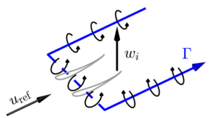
Regenerative wind farms with MRSLs nearly double efficiency, transforming renewable energy landscapes and reducing costs.
The Rise of Regenerative Wind Farms Read More »
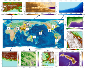
The RRDPM model improves digital elevation model resolution, enhancing detail recovery for land and seabed regions for scientific applications.
DEM Resolution with RRDPM Read More »
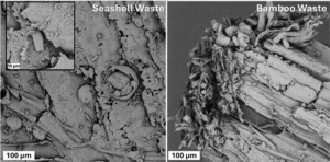
Enhancing acoustic insulation with waste bamboo and seashells in concrete offers sustainable solutions for urban noise pollution.
Bamboo & Seashells for concrete Noise Reduction Read More »
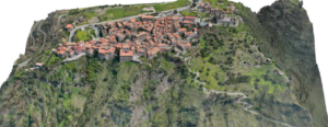
A multidisciplinary model integrates geomatics and urban planning to protect Fiumefreddo Bruzio’s cultural heritage from seismic threats.
Seismic Risk in Italy’s Historic Centers Read More »
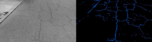
Researchers have developed a deep learning-based methodology for detecting and evaluating pavement surface damage. This approach enhances road safety and maintenance strategies by providing accurate, scalable, and objective assessments of pavement conditions.
Deep Learning for Pavement Damage Detection Read More »
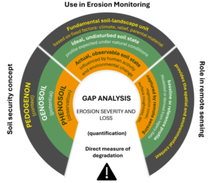
This research addresses the disconnect between satellite data and policy-making in West Africa. It introduces advanced Earth observation techniques for soil erosion monitoring and outlines a strategic pathway to integrate these insights into national frameworks, supporting efforts to achieve Land Degradation Neutrality by 2030.
Satellite Data for Soil Erosion Control in West Africa Read More »